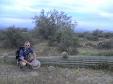
We made it! A great day with everything working together for good: all the planning fell perfectly into place! Karen snapped our picture, Gray and I had a prayer, and then we were off!
Let’s start with the weather: it was 65 degrees when we jumped off at just after 6:00am, but cloud cover throughout the day really helped keep things much cooler than they would have been otherwise--we even got a short sprinkle just as we got to lunch. It was supposed to be 102 at the bottom but I don’t think we had to deal with that for more than a couple of hours. Even had a pretty steady breeze most of the way.
 The north side of the Grand Canyon down to Roaring Springs is really pretty. It is a bit more wooded and the rock has some pretty blue streaking along with the red and white (very patriotic).
This first six miles wasn’t really as steep or difficult as I was prepared for and I enjoyed this stretch the most (being fresh didn’t hurt either). Passed about 15 other hikers who were headed down as well, plus another 15 or so who were headed out from the Cottonwood campground.
The stretch from Roaring Springs to Phantom Ranch follows Bright
 Angel Creek, who is a nice companion. Ribbon Falls pours in about half way and Bright Angel Canyon has plenty of its own beauty to enjoy. We saw a few more people headed north out of Cottonwood but below that camp and Phantom Ranch encountered only a dozen or more hikers (altogether we saw about 80 people on the trail, not counting those lounging about at Phantom Ranch, nor those drifting down in the last mile from the top). It seems that many people who do the Canyon rim-to-rim have the sense to make it a two or three night trip. Interesting idea…
A word about distances: according the National Park Service website for the Grand Canyon it is 13.7 miles from the North Rim to Phantom Ranch. I respectfully disa
 gree: based on the Garmin GPS unit we carried it was 16.5 miles. At least a mile of this is down, so if someone just spread out a map and measured the distance they would be at least that much short. That still leaves almost two miles, however, and I frankly have no explanation for the discrepancy. Coming up on the south the distances measure out: NPS says it is 9.6 miles from Phantom Ranch to the South Rim; we got 10.3 on the Garmin, but again, there is about 4000 feet of elevation change to explain the difference. All in all our expected total distance was 23.8 miles, but our equipment told us we went 26.8 miles! And yes, we would have still done it in one day even if we had known. Other Garmin tidbits: our moving average was 2.7 miles an hour but our effective pace was 2.2 miles per hour; almost ten hours of actual hiking time, and just over two hours of stopped time, which was exactly what we expected.
All that being said, the stretch from Cotton
 wood to Phantom Ranch was about an hour longer than we were expecting and that was a bit tough psychologically. We were pretty beat when we got to Phantom even though we were still in time for a 12:30 lunch (the picture of Gray says it all). We ate, refreshed our water, mixed up a fresh batch of Gatorade, changed into some dry socks and hit the trail 45 minutes after we got there.
The n
 ext hour was pretty challenging, partly because we had just eaten, partly because it was the hottest it would be for us (with no breeze), partly because the trail for most of the way was soft sand. But mostly because we had to cross the bloody suspension bridge. I am mildly acrophobic so the idea of walking 300 feet over a narrow bridge suspended 75 feet about the Colorado River is enough to send me into a minor meltdown. This was the one thing I wasn’t prepared for at all, and my son telling me to look down through the metal grate didn’t help (told that boy to shut up so I could focus on walking and breathing!).
About two miles after the bridge the trail turns away from the river and there is only one way to go—up. Not too long after starting in that direction the hiker encounters wha
 t is referred to as the Devil’s Corkscrew. This is a series of switchbacks, fairly steep, that penetrate up through the red rock, all of which lends to its colorful name.
The reward, however, is just ahead as the trail enters the lower end of what becomes Indian Garden Campground. As the name suggests there is lots of vegetation along a creek which provides some nice shade and a hint of cool. We got there about 3:00 and were feeling pretty good until we saw the mileage sign—another four plus miles, and oh! what miles they are!!
 From Indian Garden to the top is over 3000 feet of up, up, up. I’m sure that our overall average speed had been much higher until we hit this stretch, which is further punishing because the higher you go the thinner the atmosphere. Now I know why so many people need to be rescued out of the Canyon…they go down a few miles with one water bottle in their hand and it seems so easy, then they have to turn around and climb back up! We did see several people about whom we had grave concerns—we didn’t hear about any rescues so we presume they made it!
About 6:30 we finally made it up the last bit. It’s kinda funny because the last half mile or so is crammed full of people strolling down for a little closer look—they aren’t trying to do a
 nything except get a better picture. But I could tell from their faces how startled many of them were to see two sweaty and dust-crusted hikers come upon them! We were sure glad to see Karen and Kellen waiting for us at the top, and a group of four teenagers who had heard from them what we were up to even cheered for us as we came by.
I can honestly say that I have never been so physically tired as I was that night. I had to lay on the hotel floor for about an hour before I could even think about a shower. Movement was painful, and going up or down stairs for the first day or so was pretty much impossible. But we did it.
 The folks I really salute, however, are the people who originally created the trail. A lot of people spent a lot of time to carve trails out of solid rock, to build buttresses against rushing streams, to dig and reinforce hundreds of stairs…all so people like us could get down into the Canyon and wonder at the handiwork of an even more amazing Creator.
And what a job He did!